Hide + Seek DC 3: Rowhomes & Alleys
This past weekend I ran a third game of Jet Lag’s Hide + Seek Transit Game with some friends in the DC metro area, using WMATA Metrorail (you can find the first game’s writeup here, and the second here). As before, this post is a play-by-play and a post mortem, though by now I think we’ve got a pretty solid ruleset.
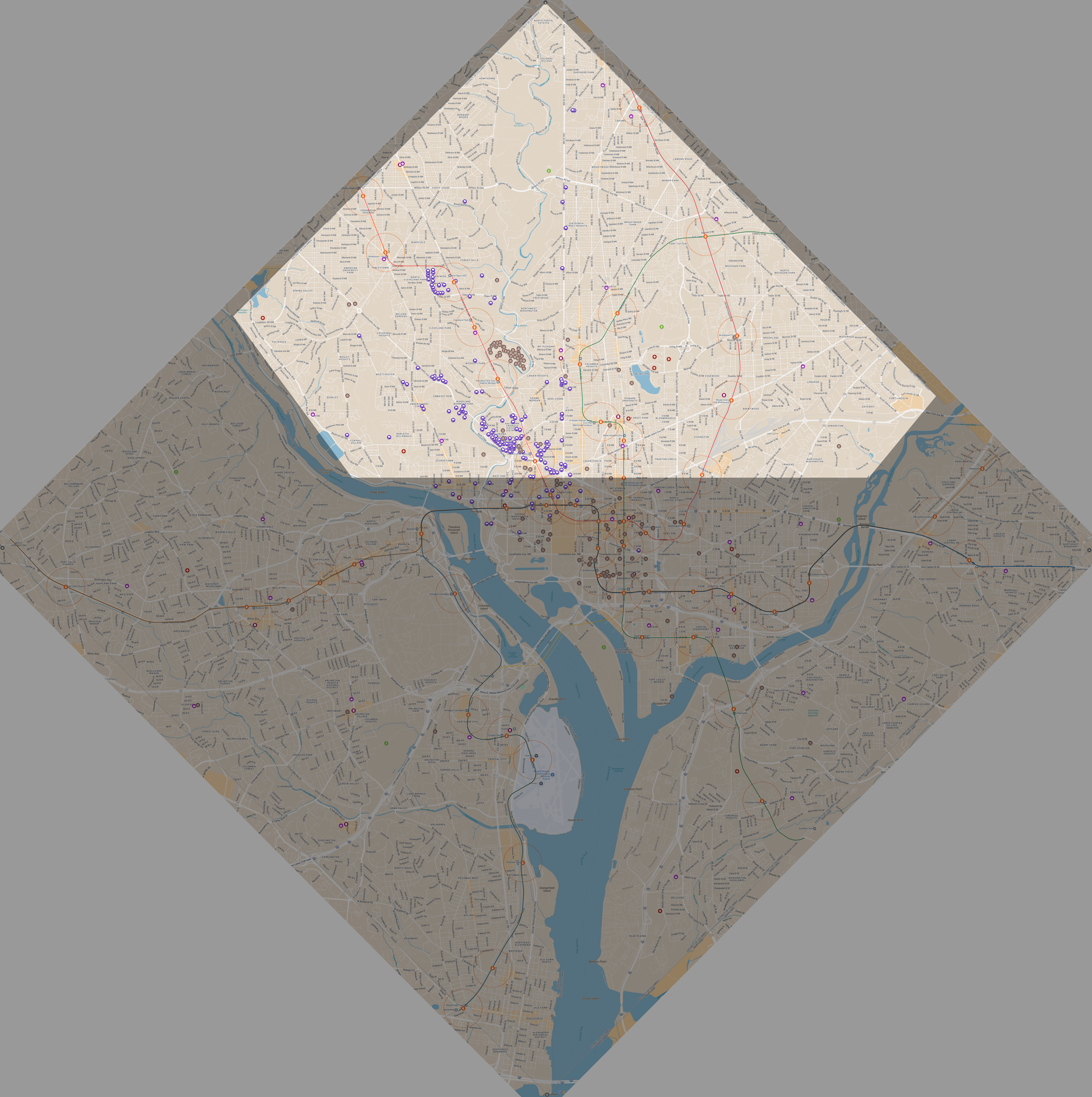
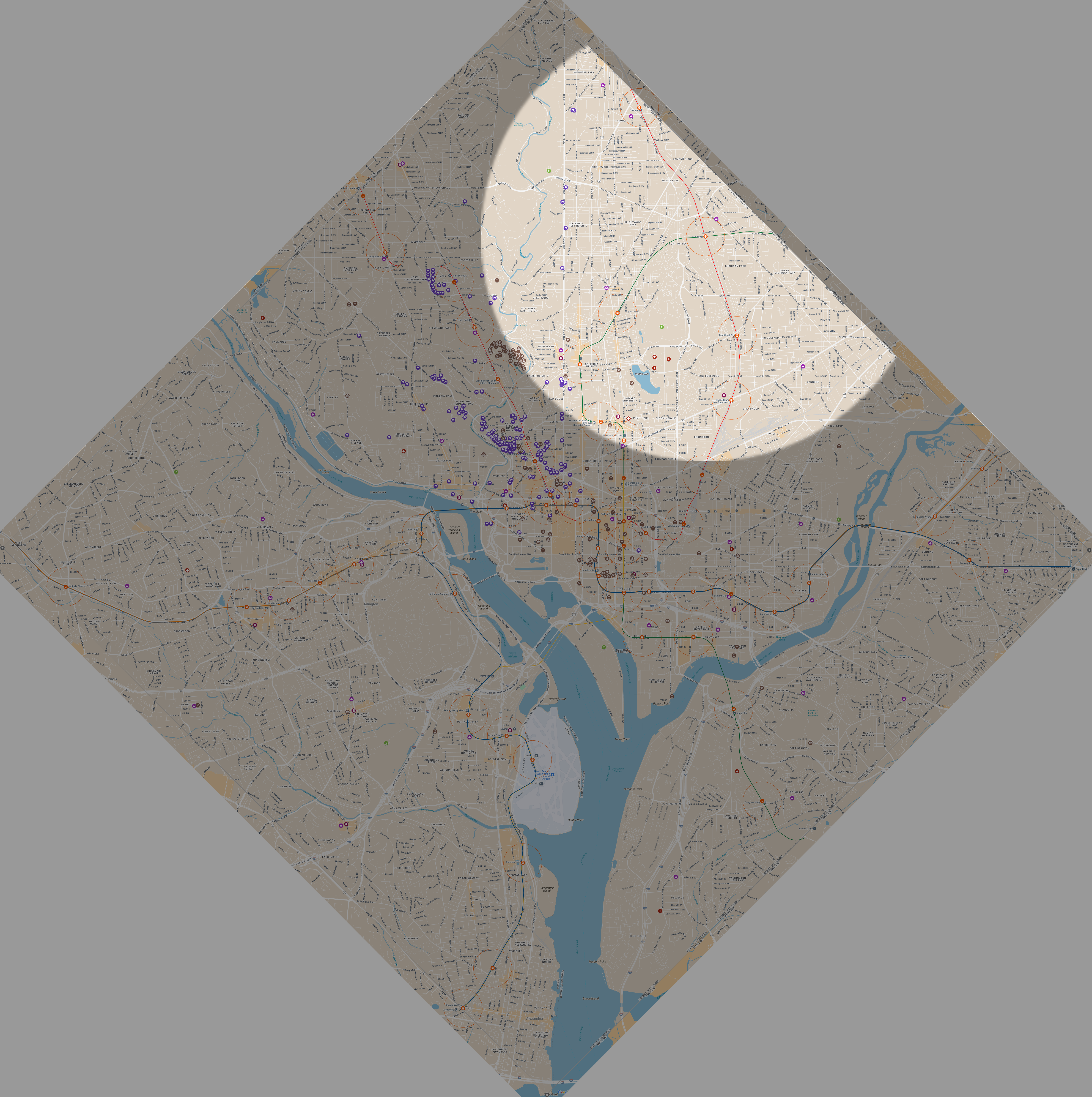
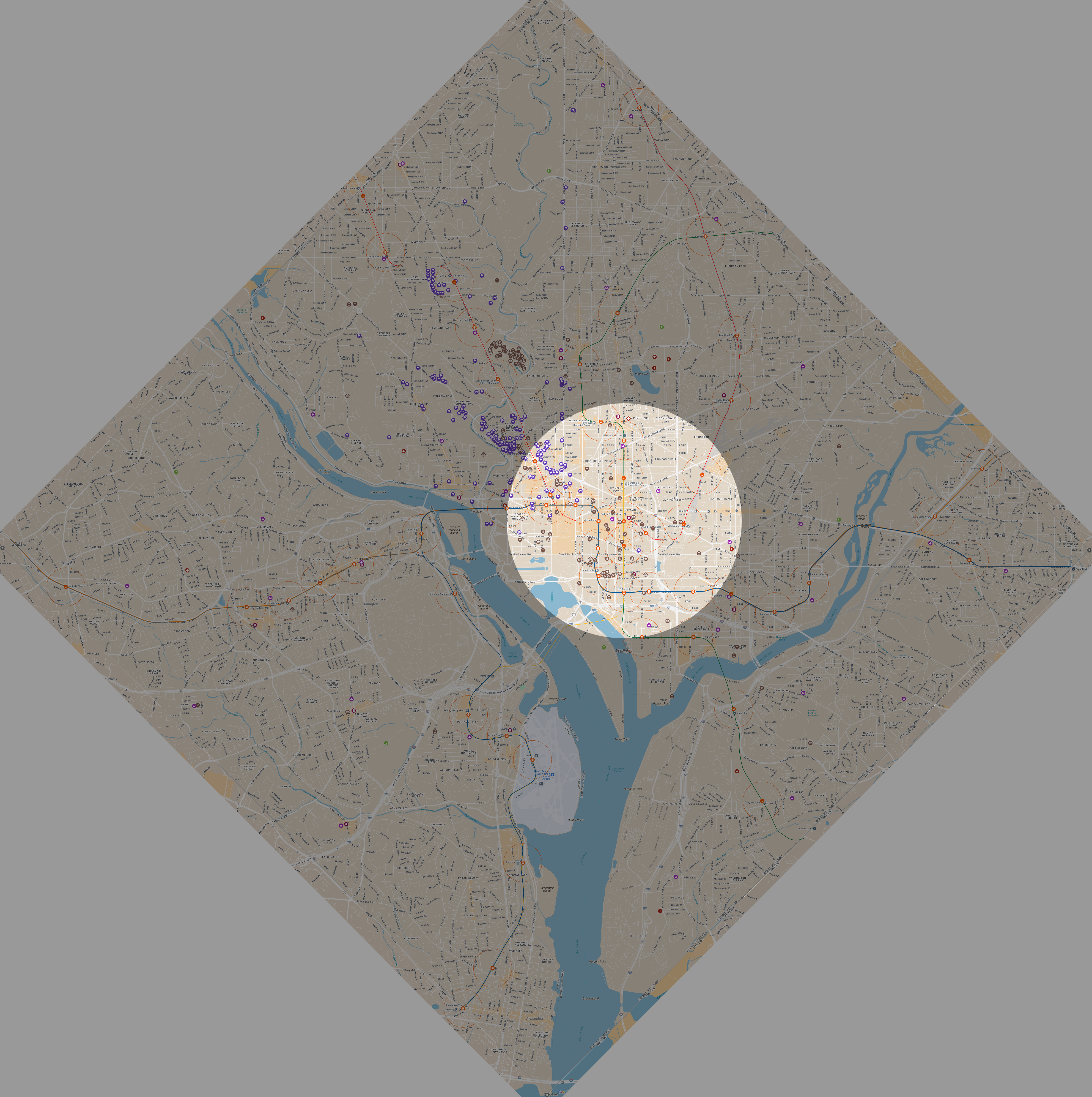
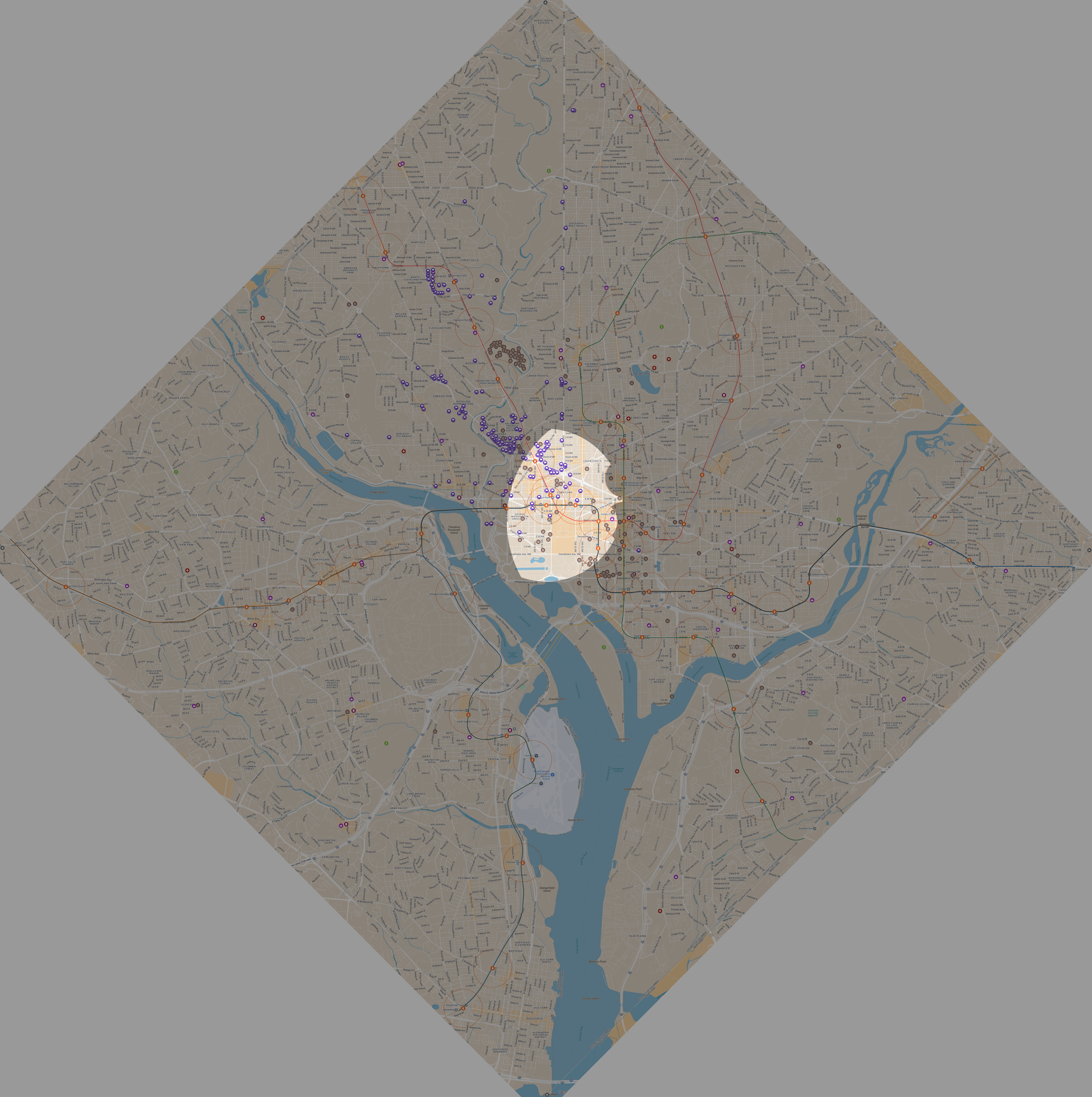
We used the same play area as previous runs: the square formed by the original DC boundaries, encompassing all of DC as well as the portion that was retroceded to Virginia (Arlington and a portion of Alexandria), minus Pentagon station. This sizing put us at a ‘small’ game size with Metrorail stations as our transit stations and hiding zones. Hiding time was extended to 40 minutes with a reset to Metro Center between hiding rounds.
We also used the same seeker question reference I made for our second run, and the same set of preset POIs populated in the Google MyMaps map as well. Both worked well on the previous run, and I saw no reason to change things.
This time we had 6 people show up, so a clean 3v3 game. We started at Metro Center with a 40 minute hiding time, and decided to reset to Metro Center between hiding rounds as well.
Round 1: Seeking
My team won the flip and chose to seek first. I think it’s nice to get the “hard work” out of the way first, especially while it’s earlier in the day. Seeking as it gets dark, as I found out last time, sucks. The downside is that if you hide first, you can often get a nice lunch in while you do so. After giving folks some time to discuss strategy, the hiders set off at 10:37 and, 40 minutes later at 11:43 we fire off what has become our classic starting question—Matching - Landmass, which returns a yes. They are somewhere in DC, between the Potomac and Anacostia.
While we were waiting, we talked through or decision tree, so with the answer in hand we walk over to Gallery Pl-Chinatown to get on the Green line and at 11:43 kick off a 1/2 mile Thermometer starting at Mt Vernon and ending at Shaw-Howard. This gives us a clean north/south bisect and separates most of the downtown/denser stations from the further north ones.
From here, the big challenge is disambiguating the eastern and western branches of the Red line. A thermometer is often a good option, but of course we just used our 1/2 mile one, and a 3 mile east-west thermometer is really hard to pull off. We figure that we can run a custom radar from one of the eastern Red line stations to separate them, and start heading to Fort Totten via Green line. While we do so, we fire off a Photo - Tallest Building in Sightline at 11:51 to mull over. That gets us the following at 12:01:
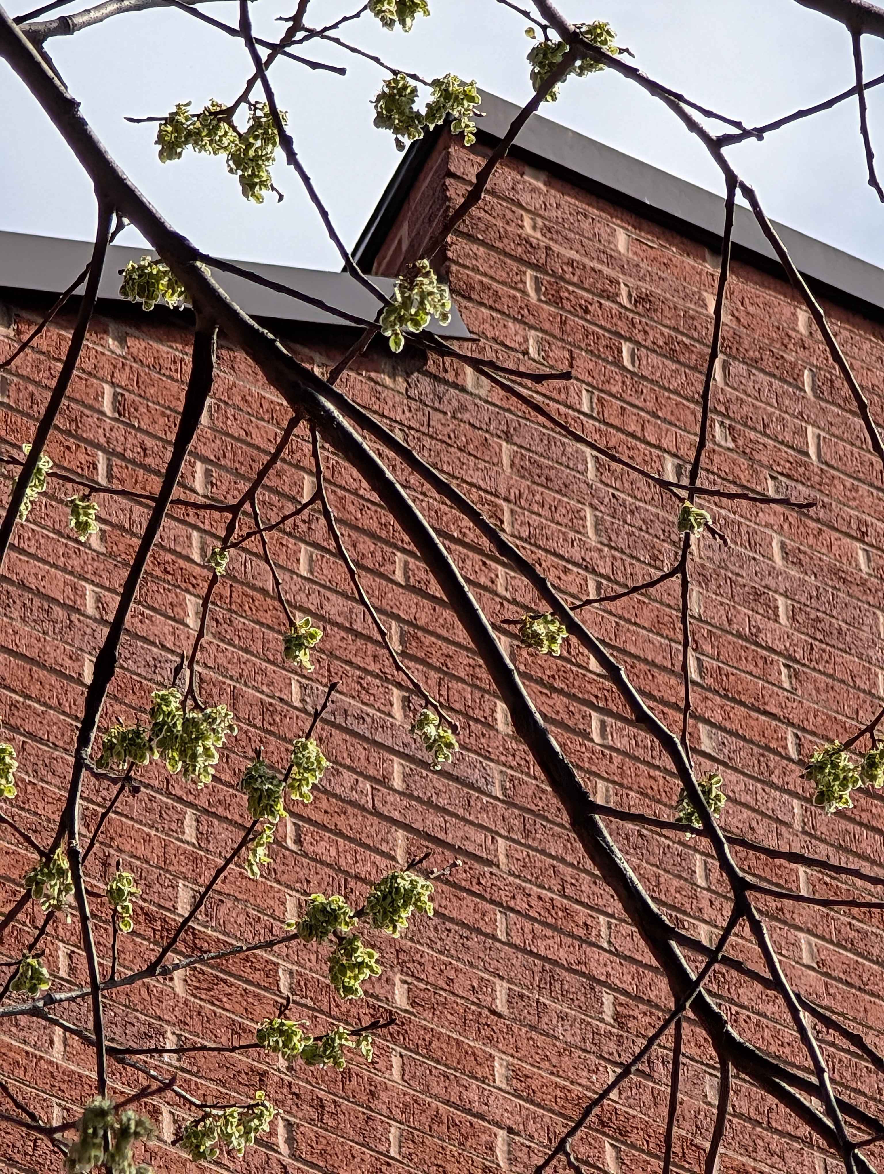
The angle makes it seem like this isn’t a super tall building, plus it’s brickwork, so we think the downtown stations—Dupont, Mt Vernon, NoMa—are unlikely, though can’t be ruled out entirely. That still leaves all the Red and Green line stations, so no change of plans.
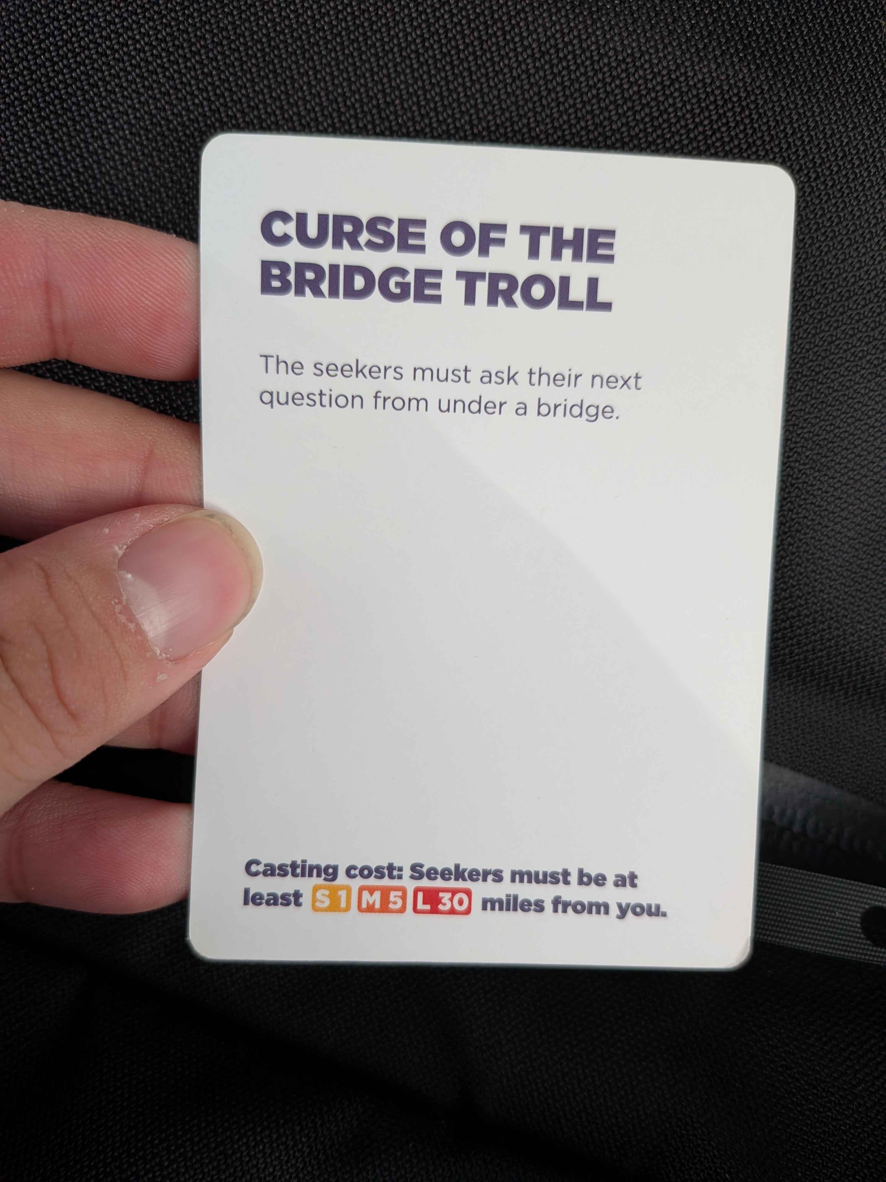
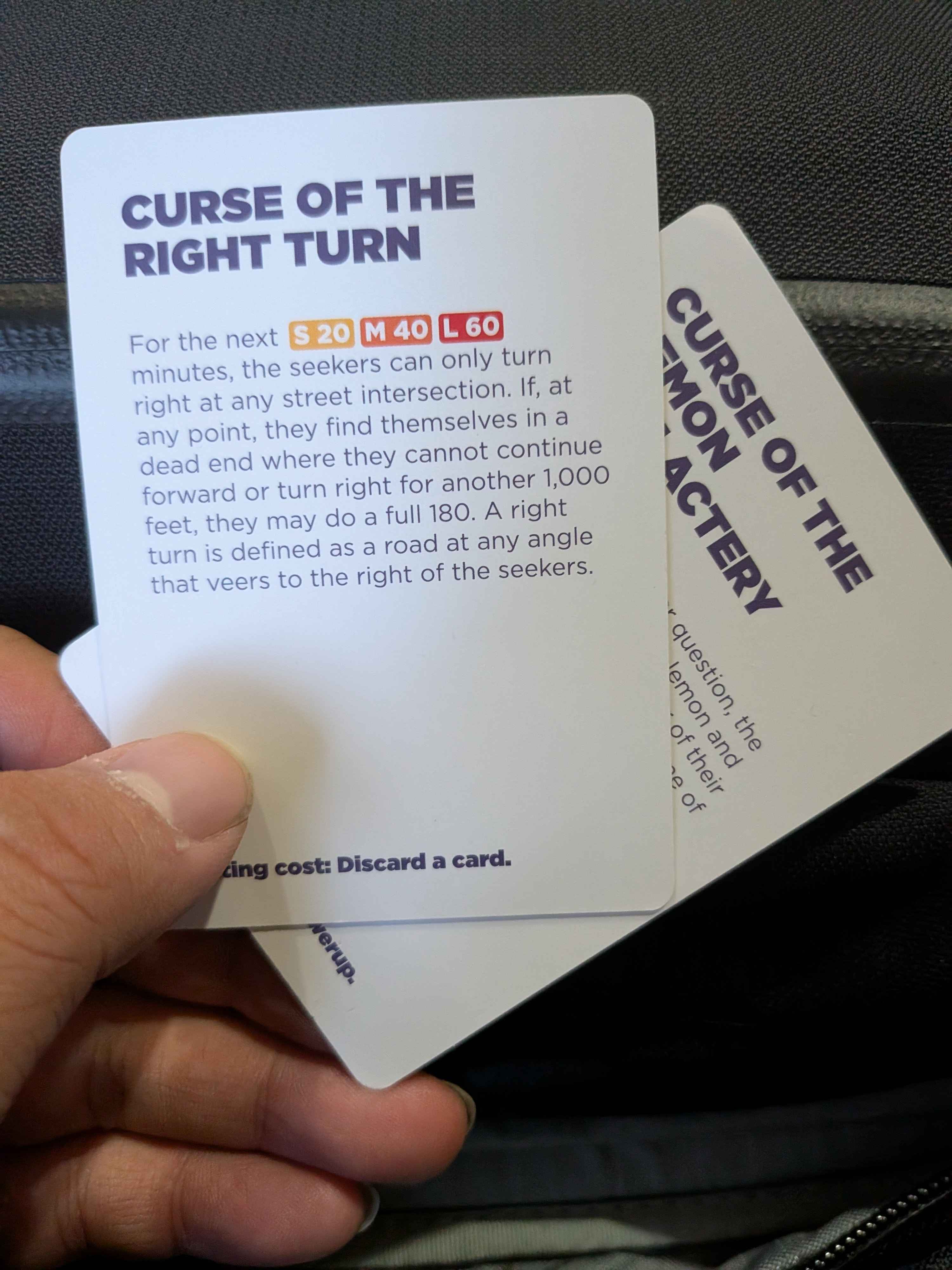
It also gets us a lovely curse
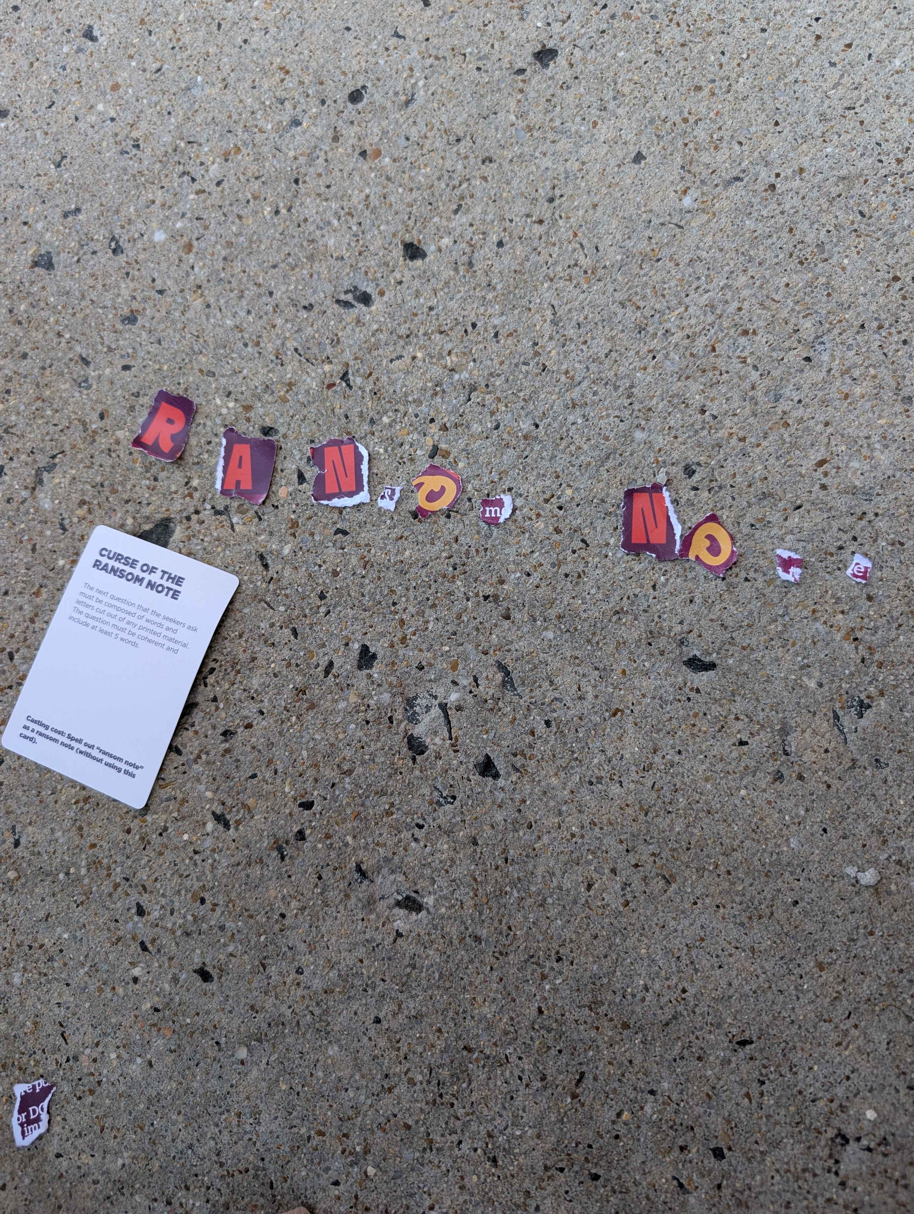
This is annoying, but for three questions in not too bad, just a time-waster. We arrive at Fort Totten and I pick up some random brochure from the station attendant stall on our way out. Turns out there’s a library literally across the street from the station exit, so we head in and borrow a pair of scissors from the lovely attendant and a newspaper from the rack, and find a quiet corner to work. So much nicer than having to tear out the letters by hand from a greeting card, that suuuuucked.
Most of the work was figuring out exactly what question we wanted to ask. In the end, we didn’t need to burn our custom radar just yet and a 3 mile radar would cover all the eastern Red line stations and exclude the western half. It wasn’t perfect—we clip portions corner of NoMa, Shaw-Howard, and U Street instead of completed including or excluding them—but the split stations were ones we felt were unlikely anyways
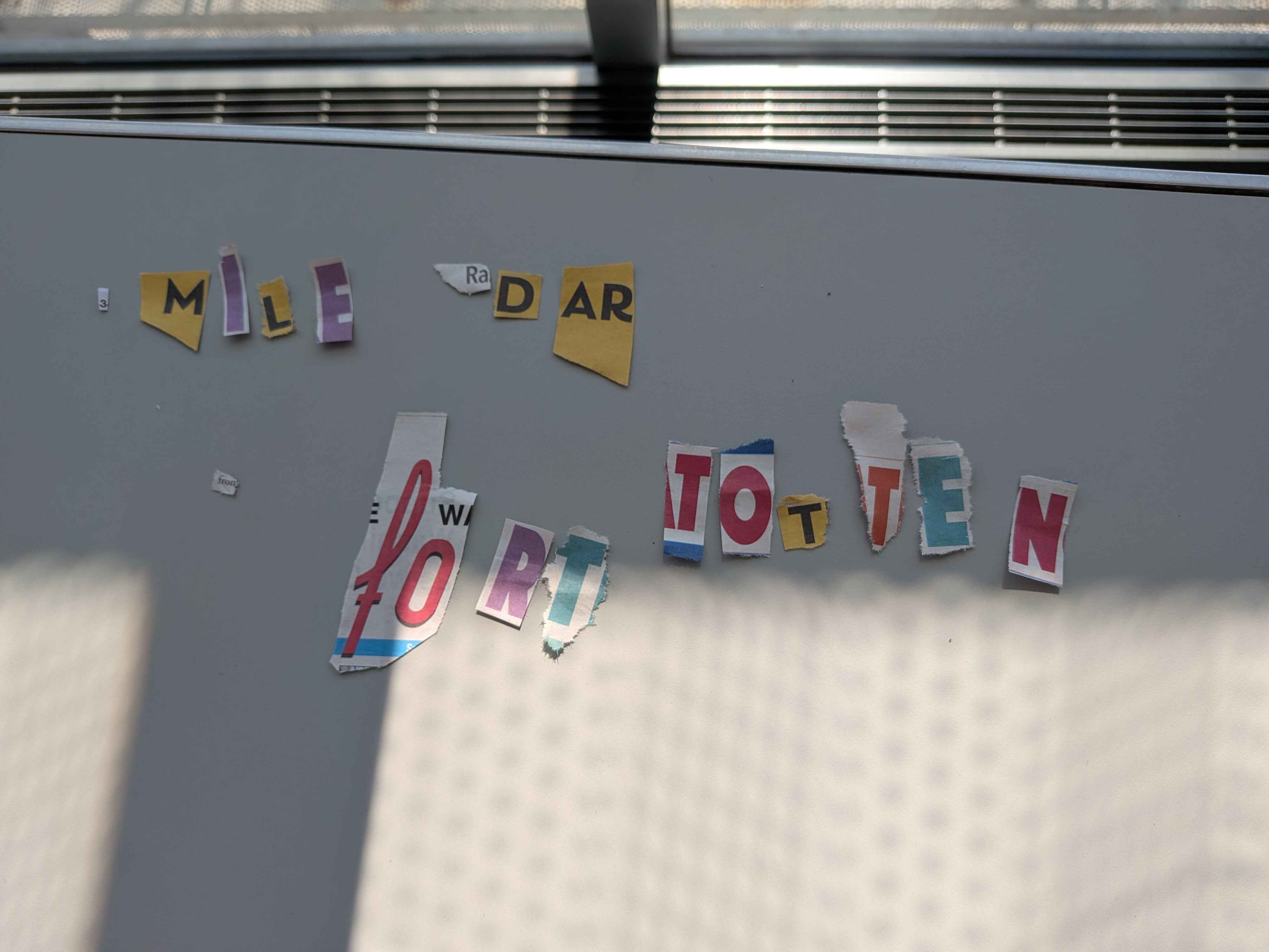
We fire off the question at 12:44 and get a “yes” back at 12:49. Nominally the worst option, but it does mean we don’t have to run all the way back to the east and can stay in the library while we plan how to bisect our remaining stations
I think we misplay here and get a little too cute. We really want to eliminate the downtown stations to ensure no backtracking, and also need to figure out if they’re on the Green or Red stations. In hindsight, we should have just used a transit line matching question (which we do do later) to disambiguate the two, but instead I spend like 5 minutes playing around to find a custom radar to thread the gap between Columbia Heights and U Street. 2.5 miles with a bit of careful positioning does the trick, and we ask at 13:07 and receive a “yes” at 13:12
From here we start traveling south on the Green and ask a Matching - Transit Line at 13:13. Based on architecture we think Green is more likely than Red (hence matching Green) and having been at Fort Totten we think that it’s unlikely they’re there. That leaves only Petworth and Columbia Heights, and we decide to hedge and get off at Petworth while we wait for an answer. The reply comes at 13:18 and confirms that they are in fact on the Green line, so we immediately follow up with a Photo - Building Outside Station Entrance question. Either they’re at Petworth and can’t answer, or they’re at Columbia and we can start heading over immediately after getting the answer and hopefully catch them out, or they’re at Fort Totten which we should be able to recognize immediately.
They veto this question, which we figure means most likely Petworth but possibly Columbia still, so we hit them with a Photo - Widest Street at 13:33 to check. This, as expected, gets a “can’t answer” back and so commences the endgame. We follow up with a Photo - Selfie question at 13:55. It’s between this, Sky, and Tree and Selfie tends to give the most information regardless if they’re indoors or outdoors.
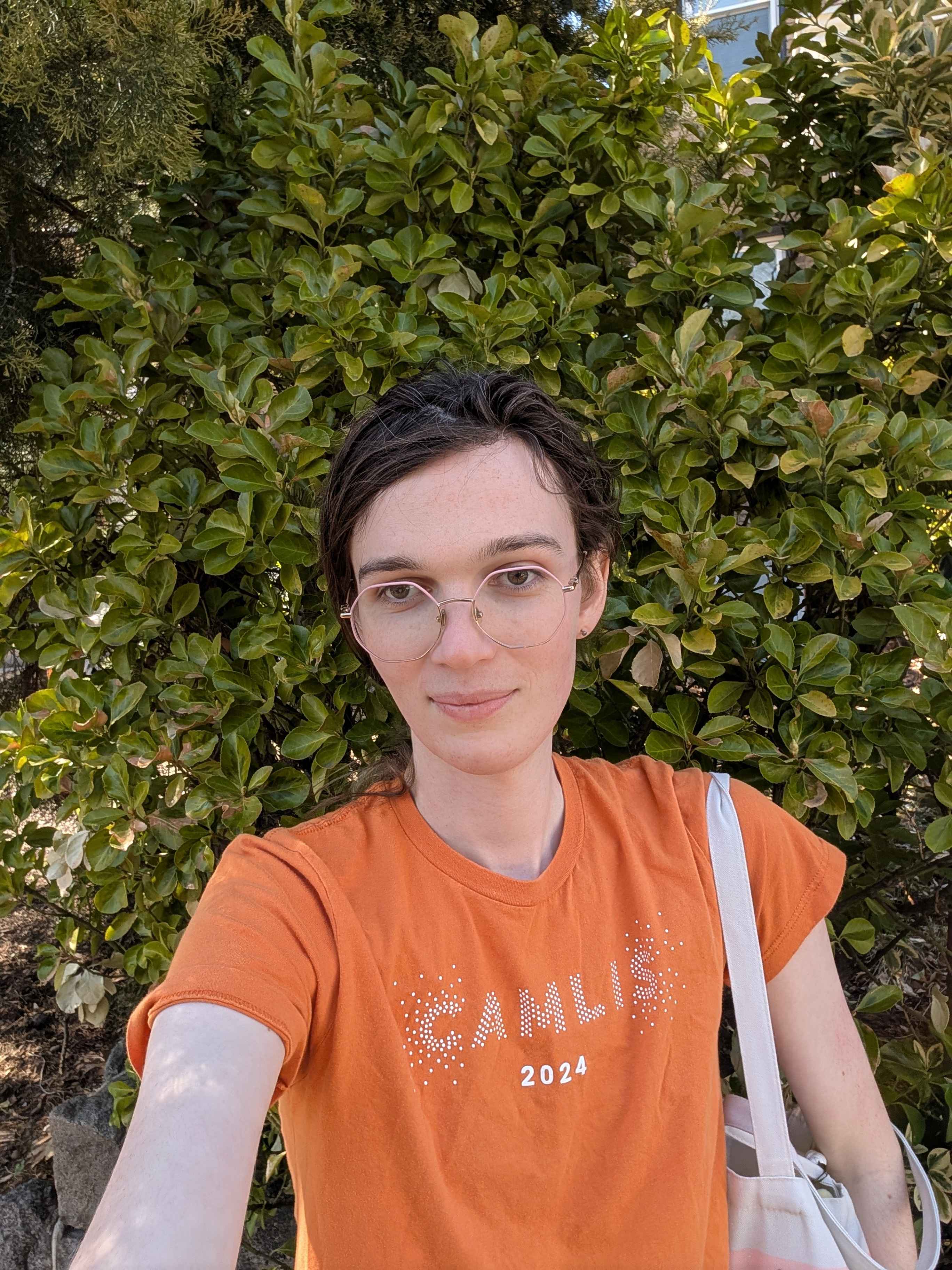
Unfortunately for us, the selfie indicates that they’re outdoors, and just standing in front of a bush of some sort. We can see some glass in the background and some stone in the foreground, so it seems likely they’re just hanging out in front of a rowhouse. And… there are a lot of fucking rowhouses in this hiding zone. We need to narrow it down more, so we walk out to the southeastern edge of the zone and run out a 1/4 mile Radar at 14:06, the idea being to split the zone with New Hampshire Ave as the midpoint.
Thankfully we get a yes back for this at 14:10. Unfortunately, this is still plenty of rows to check, so we start from the southern end and laboriously zigzag our way up. Near the middle we figure we might as well ask another photo, it doesn’t give them selection and it might speed up finding them, and even if they curse us it would have to be one that doesn’t just stop us from asking more questions, since we could just ignore those. Given they’re fixed in place, we settle on Photo - Tree at 14:26.
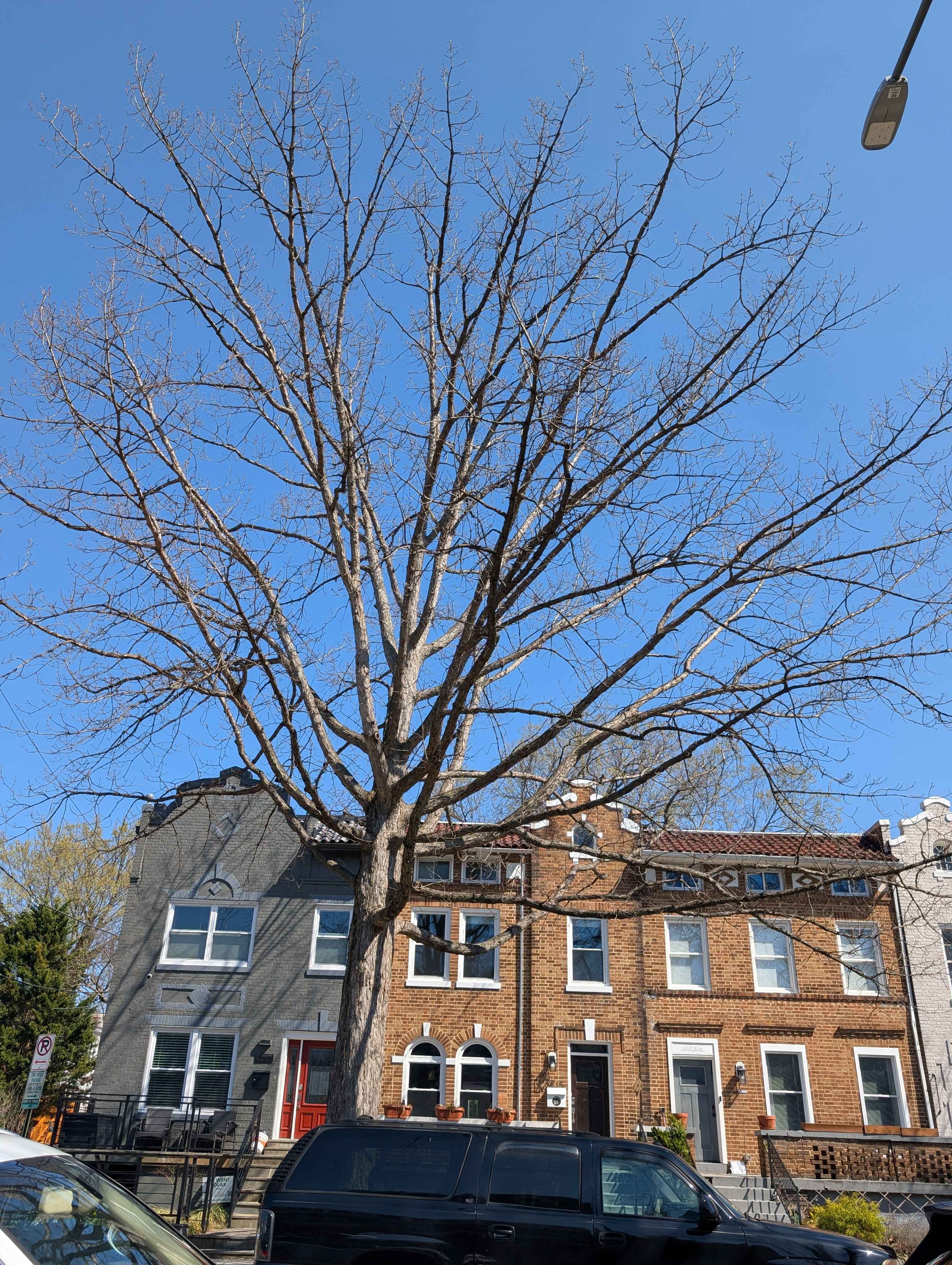
At 14:35 we get this pretty nice photo with clear views of multiple houses, maybe we should’ve asked earlier. And, funnily enough, as we begin to reach the last few streets to check one of my teammates spots the red door in the corner just a few minutes after we get the photo back. A few more steps around the corner and, exhausted, we finally find them sitting on the steps outside a rowhouse at 14:37. The last question was basically a waste, as we would’ve found them within a minute or two anyways, but it did wonders for our mental health lol
Final time for the hiders is 3h20m with 20 minutes in time bonuses, for a total of 3h40m.
Round 2: Hiding
After a quick lunch at Two Brothers Chicken (lowkey fantastic fried chicken, may have to come back) we get started on our hiding round. Since it’s nearly 15:00 by the time we sit down to eat, we decide to have us start our run from Petworth with an extra 10 minutes (total 50m) hiding time to ensure we can reach the full system, and we have the seekers ride back to Metro Center a little before we begin our run. This means we’re burning less time with the full reset, but we as hiders have the full system as options and the seekers still get to start at a central location for their questions.
In any case, we kick off our hiding period and begin riding down the Green line as we discuss options. We’re all tired enough that we don’t want to go out super far (especially not to Anacostia, which we had floated early in the morning). We end up deciding to hide somewhere downtown at one of the stations that have overlaps, figuring this lets us get a bit tricky with several of the questions. There’s a few options, and we consider Metro Center (intersecting Gallery Pl-Chinatown), but settle on one of the Farragut stations. We’ve got plenty of time before our hiding period ends, so we explore our options a bit and settle on Farragut North, especially since it even intersects with Dupont Circle just a sliver.
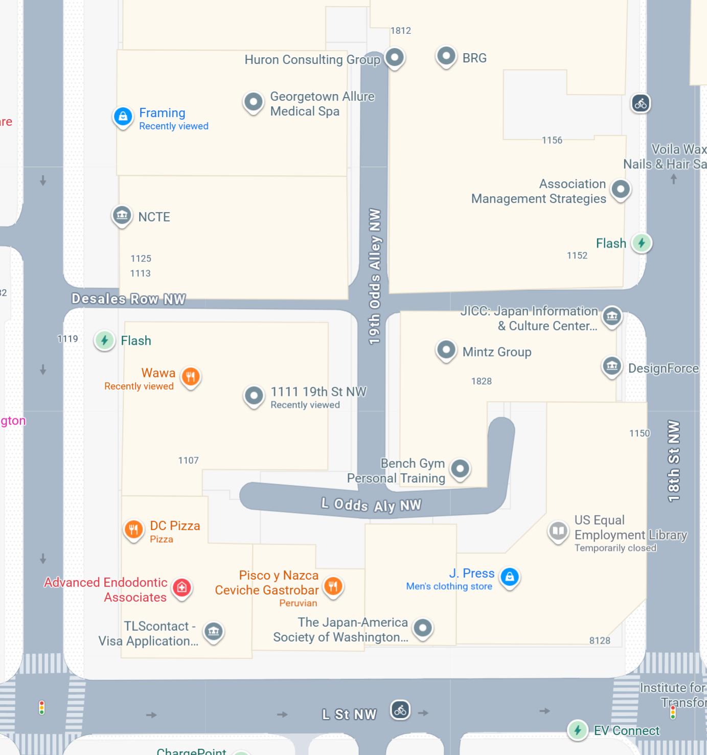
At 16:40 our hiding period ends and the seekers open with a Matching - Landmass as is tradition. They are still in DC, and we are as well. They follow up at 16:47 with a Photo - Building Outside Station Entrance which we return at 16:56 with the following
We actually talked about this a bit with the other team when they asked why we led with tallest in sightline before endgame, since the free movement allows for greater manipulation. I think that still gives a lot of room to reveal information about architecture and density, and like saving the station photo question as an endgame check. On the other hand, having the station photo earlier makes it easy to dip in and out of stations to see if you recognize anything, and the building might be more identifiable via satellite view.
Either way, they’ve gone for the station photo and we give a fairly generic one, although it’s pretty recognizable once you’re there—although it’s off to the side, so not blatantly obvious. I think it’s a more generic architecture style than our other options too, though it still definitely indicates a more built-up area.
At 17:02 they start a 1/2 mile Thermometer from Gallery Pl, and we hit them with a Randomize. In a small game, the only other Thermometer is a 3 mile, so this forces them to either waste a ton of time making a 3 mile thermometer productive (nontrivial), get it done quick and make it give less information, or abort it entirely and give us free cards. They choose the last option, though they don’t immediately retry the 1/2 mile, which is interesting.
Instead, at 17:16 they use a 1.5 mile Custom Radar, which return a yes from us.
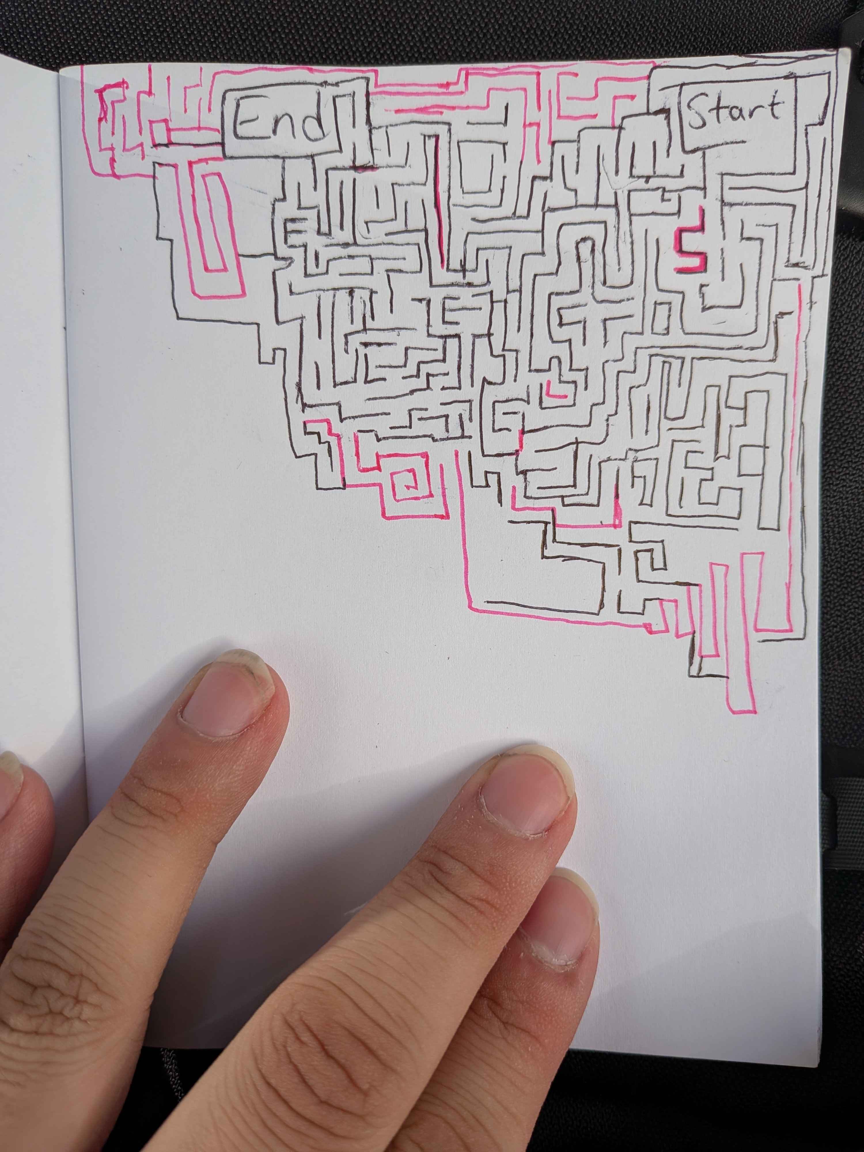
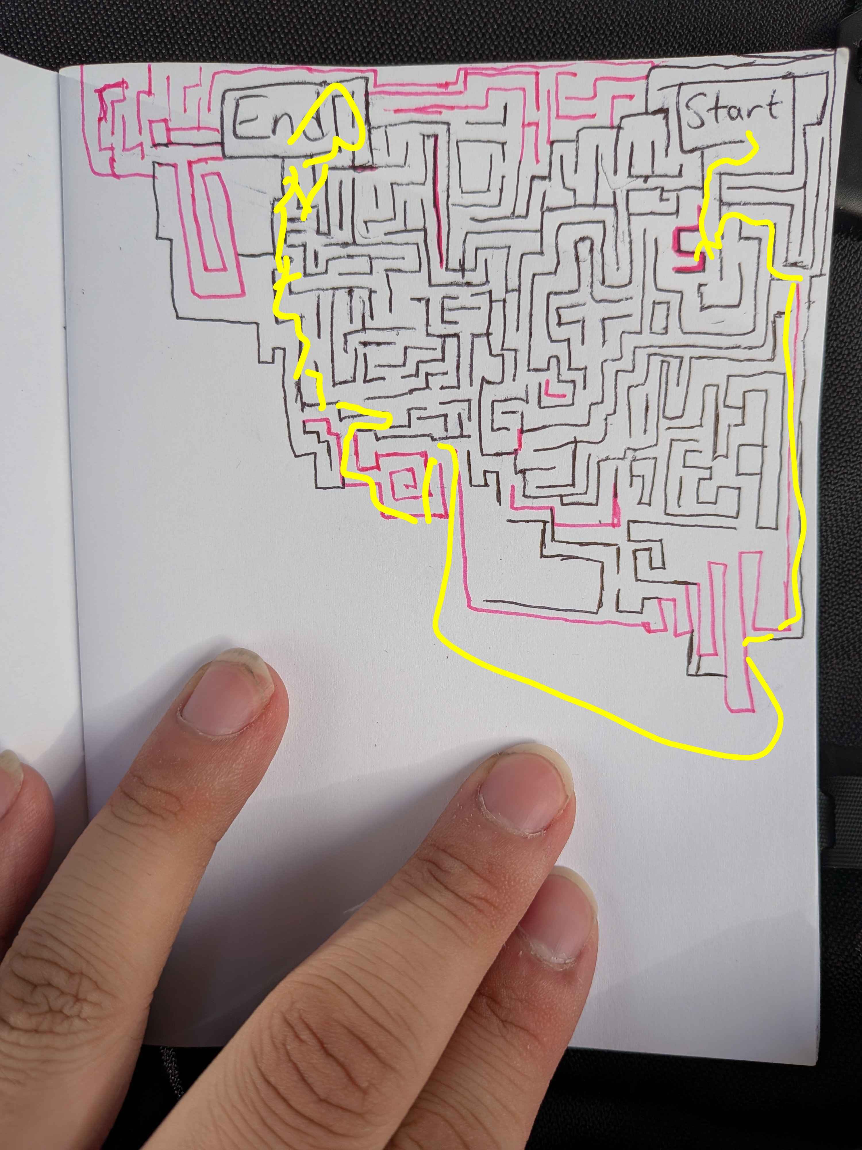
In response, we hit them with the Curse of the Labyrinth at 17:20 to try and stall them further, since we figure the positive response on the radar isn’t super actionable. We get 10 minutes to draw a maze, and they have to solve it before they can ask another question. At this point we’ve drawn a Curse of the Bridge Troll card as well and figure we can get a good delay between the two of them. They manage to solve the maze in a reasonable amount of time, sending us the complete puzzle at 17:35 while still hanging out at Gallery Pl-Chinatown. Actually, it was an unintended solution since we forgot to close a gap, but it still bought us a good 15 minutes so can’t complain
|  |
|  |
| :——————————————————————-: | ——————————————————————— |
|
| :——————————————————————-: | ——————————————————————— |
With their newfound freedom comes a new question at 17:40. They’re on the Green headed south, and asking a Matching - Transit Line which returns no. This eliminates all the stations that touch the Green—U Street, Shaw-Howard, Gallery Pl-Chinatown, Archives, and L’Enfant leaving them the Farraguts, half of Dupont, Judiciary Square, Union Station, and NoMa. Basically, either a cluster of downtown stations or a scattered few on the eastern half of the Red.
We notice they’re on the move again, and headed our way, so before they can get within a 1 mile radius we hit them with Curse of the Bridge Troll at 17:44.
They also seem likely to end up in our zone, so we sprint over to the hiding spot we identified earlier—a nasty little alley that splits off in center and has one branch that leads to a secluded little loading area, requiring two turns to get to and very much out of casual sight. We’re in the southeastern corner, not in that 4th turn up but tucked into the loading dock.
Unfortunately, we overlooked one thing. Many of the Metrorail stations have divided platforms, and so by the time they arrived at their station at 18:01 they simply asked their question from underneath one of those passes. A 1 mile Radar from Farragut West, which we obviously answer yes to.
They follow up at 18:27 with a Photo - Tree question which gets a “cannot answer” back from us, and endgame is on. We don’t know if they know we’re in Farragut North, so we keep a careful eye on the tracker in case they move out of the zone at all and we can reposition to be even more tucked away, but in the end they never do.
At 18:43, after walking around some (and we believe identifying our station photo, so likely cementing us as being in Farragut North) they ask us a 1/4 mile Radar which attempts to bisect the hiding zone, same as we did ourselves. They’re at the eastern edge, so this gets them a no.
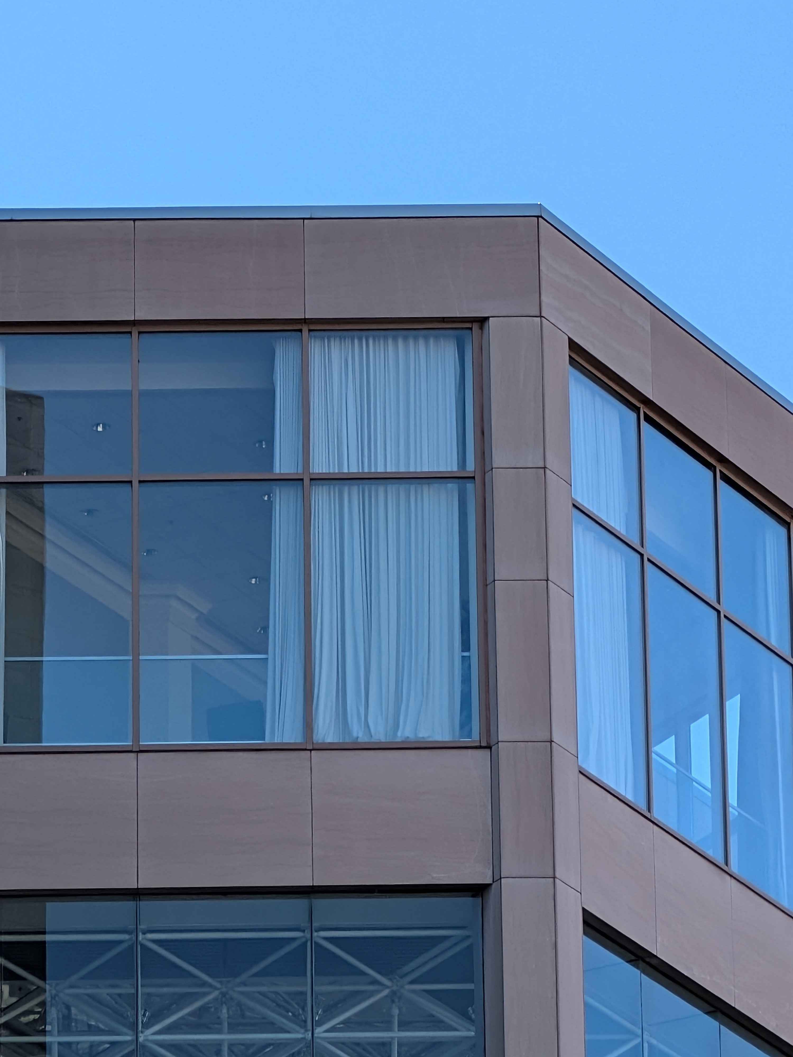
At 18:50 they ask us for a Photo - Sky, and get this beauty in return
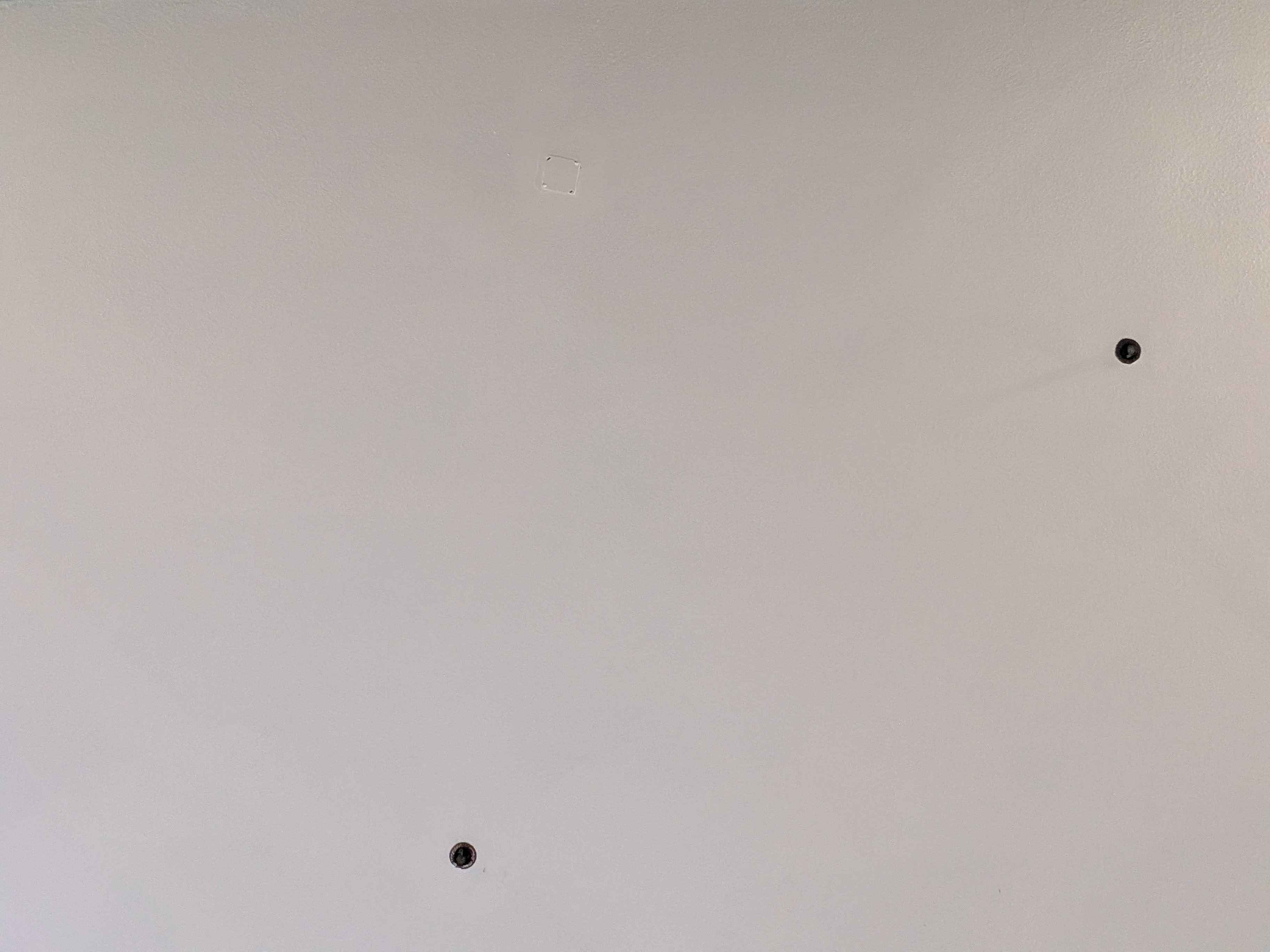
Absolutely useless, and probably worse than useless since it ended up making them think we were inside or in some kind of parking garage. In fact, there was an overhang over the loading dock we were sitting at and it was simply featureless white ceiling with a few sprinklers. When we first got there and realized that was what the Sky photo would look like if they asked it we died laughing for a few minutes.
To keep up the stalling, at 18:58 we deploy a Curse of the Right Turn to slow them down further and maybe bait them out of the zone (they do not take it)
We end up watching them wander for awhile, actually getting kinda close to us at one point but stopping and doing a loop to turn around and head south one street short of the one that had our alley entrance. At 19:16 a security guard comes out of one of the doors and tells us we can’t be there, so we relocate out of that particular cranny and wait around the corner on 19th Odds Alley NW instead. Since our Sky photo now changes, we send them a new one at 19:20 that’s probably a lot more helpful
At this point, they’ve definitely identified that we’re in an alley, and we see them slowly check out a few of them. They come close to ours, but are a street off and check a different alley further south instead. We’ve thankfully got 30m of time bonuses at this point, so at 19:51 we beat their run time by a minute and call the game. It’s past sunset now and we all kind of want to go home :p
They probably would have found us in another 10 or 20 minutes, since the alley is clearly visible on maps, though I don’t know if they ever would’ve found us had we not gotten kicked out of that loading dock
In total, we hid for 3h11m with 30m of time bonuses for a total hiding time of 3h41m and the victory!
Wrapup
The updated map and rules reference I made for our second game continued to be fantastic and this game, and I didn’t find any tweaks necessary. Nor did the “limit 2 players worth” rule for curses come up; our team drew Lemon Phylactery but never had the opportunity to cast it. All in all, I’m very happy with this game map and ruleset, and would encourage others to try it out if they’re looking to run a game in DC
As far as the game itself, we all had a blast! We definitely ran later than anticipated despite pushing the rally time to 10:00 (you’ll notice we did not start until 10:37 anyways, though everyone got in by 10:15ish and we just gave folks some time to drink their coffee and plan with their team a bit). We’ve never had a run come close to the 3 hour mark before, so that’s something to be aware of. Thankfully with it being Daylight Savings now, the sun sets a lot later—it would have been much worse had it still been Standard Time.
Next time we can get ~9 people I’d really like to try the two seeker variant with “neutral” hider team, where the seekers race each other. Only one run should make it take less time and hopefully be an easier sell (“spend the entirety of your Saturday running around the metro” is not the most appealing sounding activity to many), and it sounds like it raises some neat dynamics. I do still have to sit down and work out the rules implications though.
Other than that, no notes! If you have any questions about the details or want the files for any of my maps/docs, just shoot me an email. Or if you’re in DC and want in on our next game, email me as well! Always happy to chat :)